Home ¦ Реестр языков мира ¦ Карты ¦ Языки России ¦ Страны мира ¦ Publications
Реестр языков мира: Как устроен ¦ Систематика ¦ Евразия ¦ Африка ¦ Океания ¦ С. Америка ¦ Ю.Америка ¦ Сокращения
Atlas of Uralic languages (AUL) will concern to the distribution of Uralic languages during 20th century. As opposed to Linguistic maps (as in ALFE) which demonstrate the spread of some linguistic phenomena Language maps proper (as in this project) demonstrate the spread of languages, or of their dialects.
The main features of maps for AUL are:
1) The community-by-community method consistently applied for all Uralic language areas in Russia. The Russia's 2002 and 2010 census ethno-linguistic data for all urban and rural communities will be plotted on the electronic map, thus creating the huge cartographic database. The question is still open whether similar data can be obtained for Finland, Estonia, Hungary and relevant adjacent areas.
2) The community data of USSR 1926 census are available for the most relevant regions and will be also added to this cartographic database and then compared to the modern data. It let us show the historical dynamics of changes in language situations during 20th century.
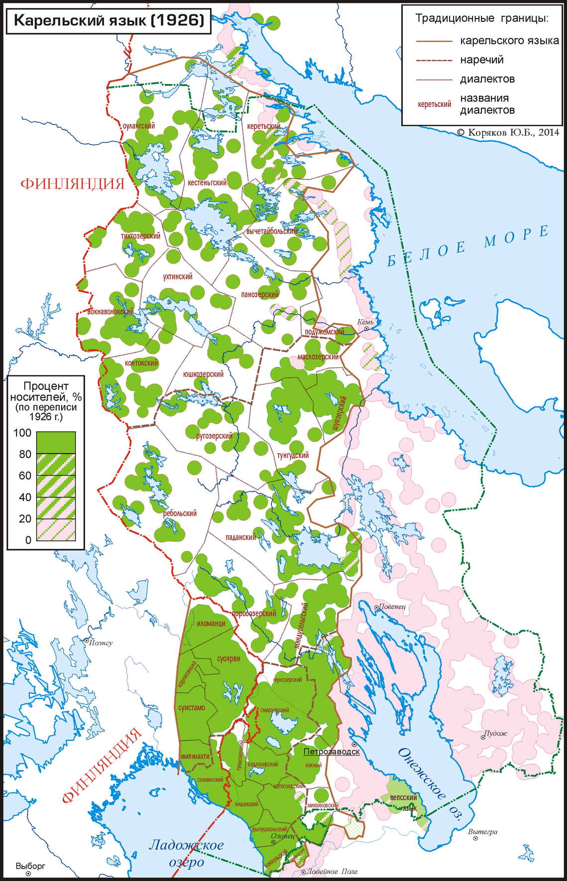
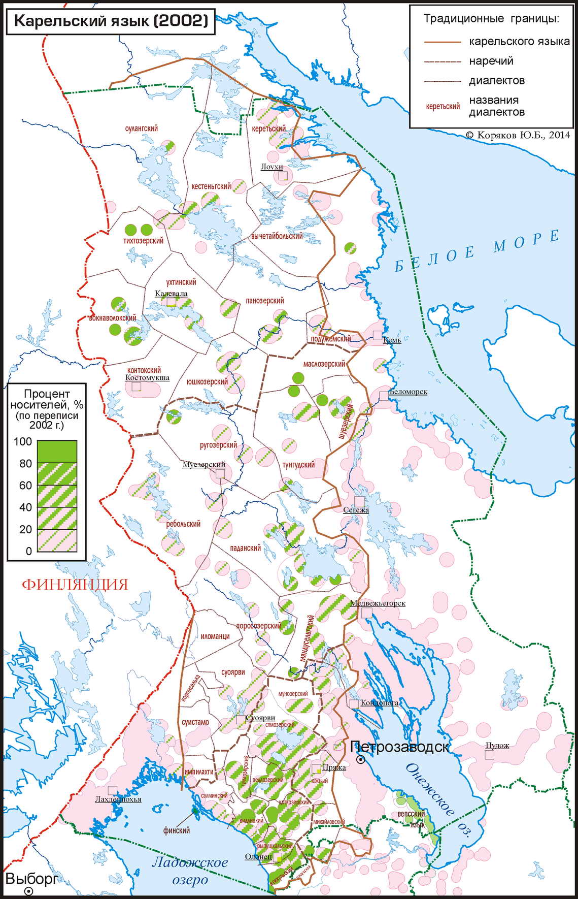
Example of Karelian language area in 1926 and 2002 (draft maps) showing drastic shrinking of this area:
Example of the Uralic languages of Russia show us the importance of such investigation. Though general distribution area of those languages has not significantly changed the language situations at microlevel have changed fundamentally. If in early 20th century speakers of Uralic languages were in the majority in many parts of this spacious area, by the end of the century they disappeared in some places and became minority elsewhere.
3) With help of this cartographic database, the detailed zoom-in maps will be created for many areas of Uralic languages with complex language distribution, both for modern situatuon and earlier time spans. They will be on a scale of 10–20 km/cm and in some cases up to 3–5 km/cm.
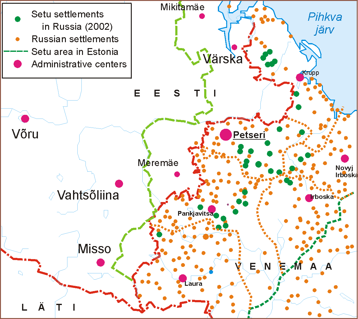
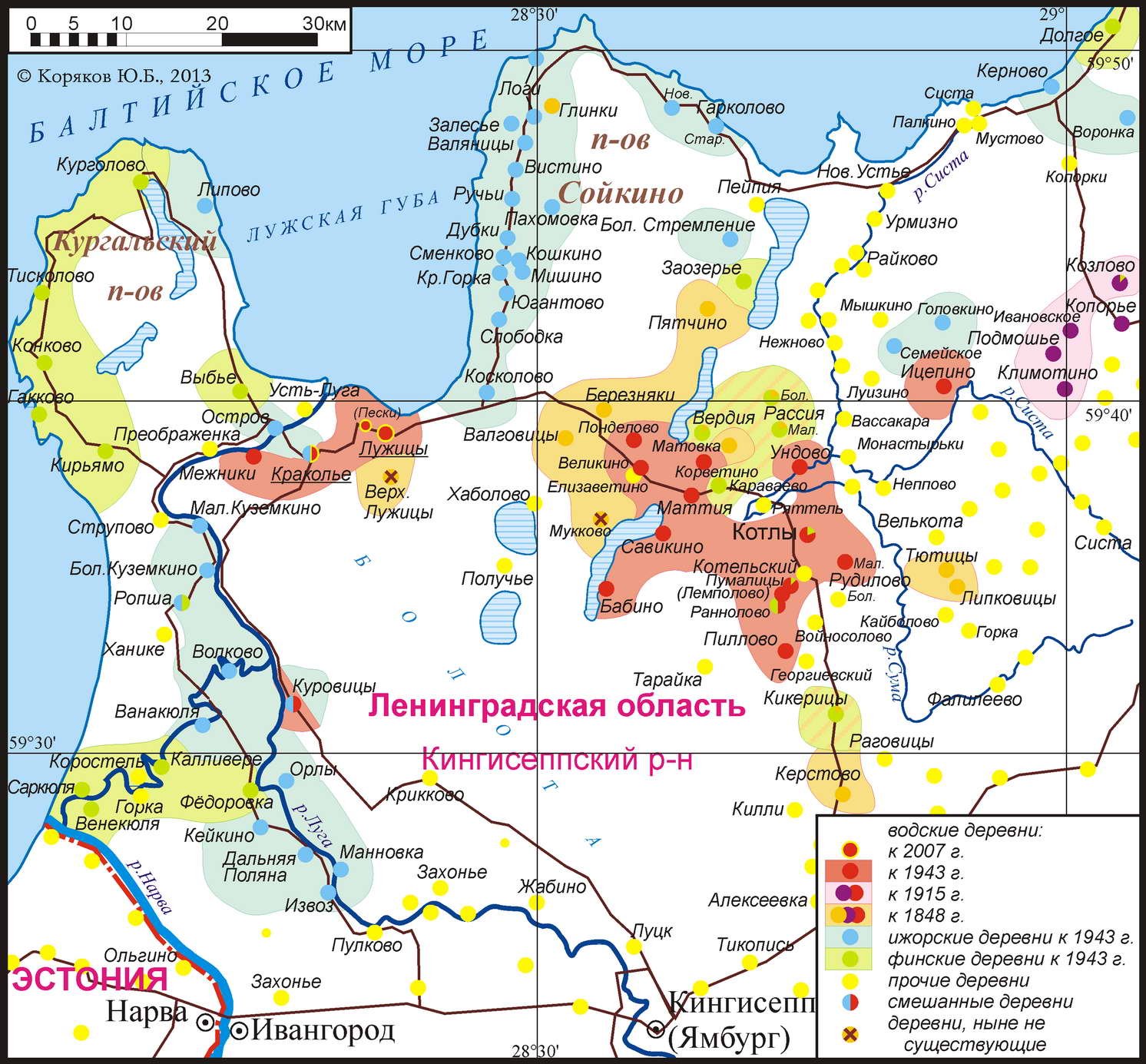
Some examples of detailed maps (Setu area and Ingria):
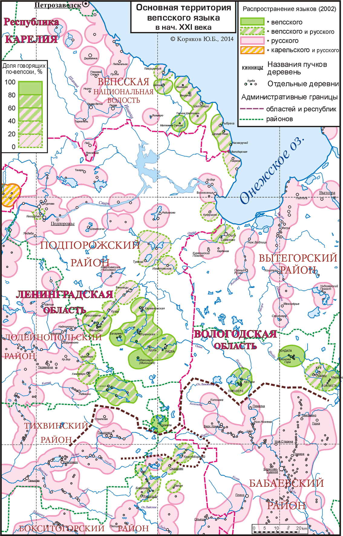
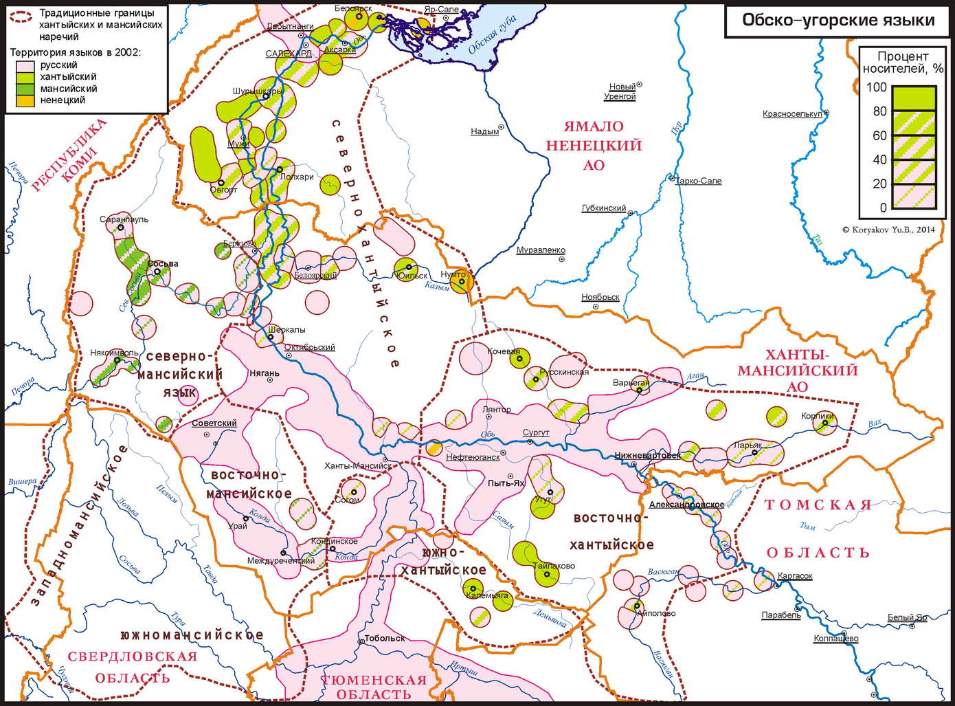
| More examples (Veps and Ob-Ugric): | ||
|
4) Then, on base of those detailed maps the more generalised maps of two main types will be created:
|
|
See also:
Koryakov Yu.B. Mapping of distribution dynamics of Russia's Finnic languages during 20th century (and the Language Atlas of Russia) // Finnic languages on the map / Õdagumeresoomõ keeleq kaartõ pääl. Conference. Karula khk, Vana Võromaa. 24.–26.10.2013. Kava ja teesid. Võru, Estonia: Võru Instituut, 2013.
Koryakov Yu.B. The changes of the Veps language area in the 19th and 20th century: cartographic perspective // Jüvä Sullõv (ed.) Finnic languages on the map / Õdagumeresoomõ keeleq kaartõ pääl. Publications of Võro Institute 28. Võro: Võro Institute, 2014. Pp. 34–51. ISBN 978-9949-9581-3-9.
Картографирование уральских языков // Презентация к докладу на Международной научной конференции «Уральские языки: синхрония и диахрония», ИЛИ РАН, Санкт-Петербург, 15–17 октября 2015.
YuK.
This page is a part of Lingvarium project website – www.lingvarium.org
| Supported by Linguistic Community | Mastered by: Yuri Koryakov |
e-mail: lingvarium |
|
|
|
Created on May 2, 2014 ¦ Last updated on Sep, 28, 2016 17:38